RealWeather
RealWeather is a system we use to bring real-world aviation METARs into DCS by pulling live weather station data and translating it into the game’s weather engine. It converts conditions like cloud layers, precipitation, pressure, and wind into DCS-compatible settings so missions feel dynamic and grounded in real atmospheric conditions. This allows Panther Den missions to feature changing skies, storms, rain, snow, and shifting visibility, making each sortie feel like it’s happening in a living environment rather than a static preset mission.
However, DCS has well-known limitations in how it simulates wind, gusting, and atmospheric behavior, which can make conditions feel unrealistic or overly punishing. To keep gameplay enjoyable and skill-based, we intentionally smooth and limit extreme wind and gust effects while preserving the immersion of real-world METAR-driven weather. Because of this, players are expected to treat weather as a core part of mission planning—checking the METAR bot daily is essential. In Panther Den, weather is not cosmetic; it is a primary operational factor, and failing to account for it means you will feel the consequences in-flight.
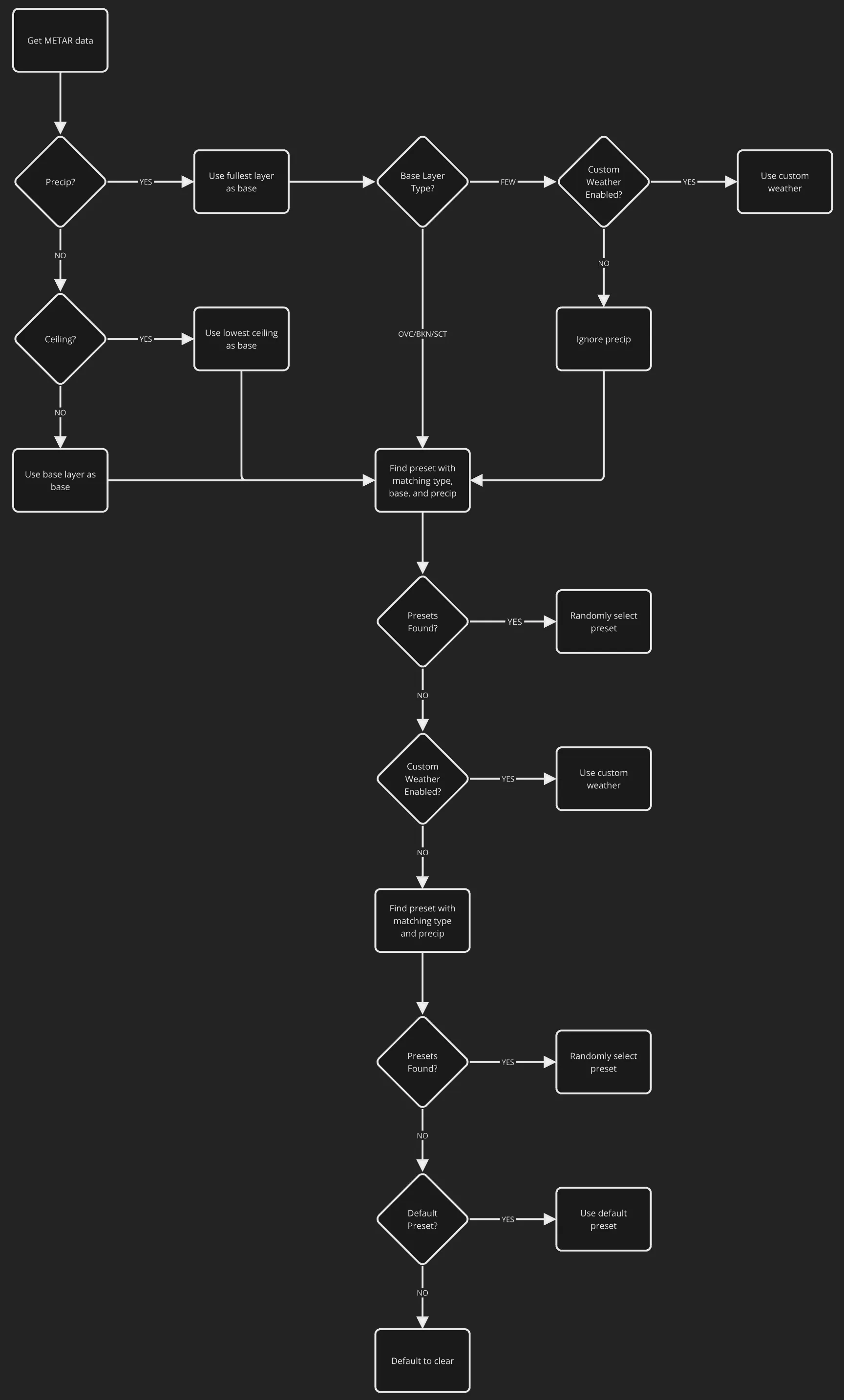
It isn’t always obvious how RealWeather attempts to match the reported conditions with the weather it creates for DCS. A perfect match is usually not possible for a few reasons, but mostly because DCS currently only allows control of the base cloud layer.
The primary goal of RealWeather is to provide a means to have automated, dynamic weather in DCS, and the secondary goal is to match the METAR conditions as closely as possible. To accomplish the latter, RealWeather will prioritize matching the conditions which are determined to be most impactful. For example, precipitation has greater precedence than a ceiling which has a greater precedence than just a base. However a picture speaks a thousand words, so here’s a flowchart that outlines how RealWeather matches the METAR conditions at a high level.